The sequence used to produce the example outputs given in this section was taken on a seven minute circuit around a rough track at DRA Chertsey. (A map of this track forms part of Figure 2.) As explained earlier, the DROID-ALTRUISM system ran at full frame rate. For every fifth processed frame, details of the estimated camera position and of the road model parameters were output to file.
In Figure 2 the X co-ordinate of the estimated camera position is plotted against Z (i.e., this is a plan view of the camera's trajectory, in the initially established global 3D ground plane). This trajectory is shown as a thick dashed line, superimposed upon a line drawing map of the area, produced photographically for the site.
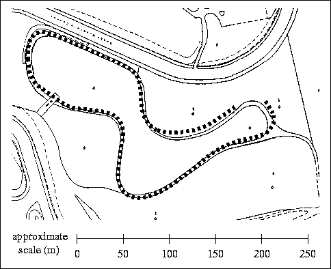
Figure 2: Estimated route taken by the camera with ALTRUISM providing
scale drift correction, overlaid on a map of the area.
Figure 3 shows an example of the feature segmentation stage of ALTRUISM, on one of the images in the rough track sequence. The model fitting has provided information about which 3D features are ``on road'' (dark features with light borders) and which are ``off road'' (light features with dark borders). The discrimination is working well.
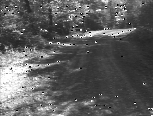
Figure 3: Tracked 3D features marked as ``on'' and
``off'' road.
Figure 4 shows an example of the drivable region radial map estimation stage of ALTRUISM. The map is projected back into the image.
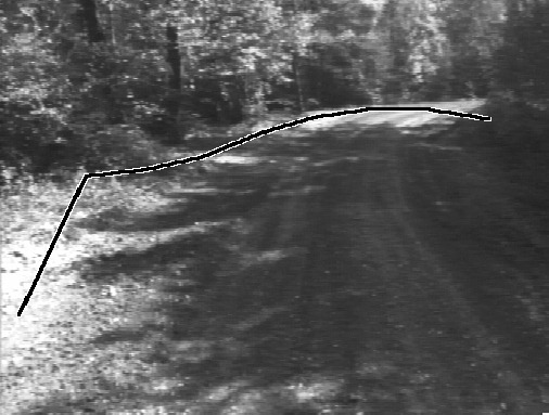
Figure 4: Estimated drivable region outline.
Figure 5 shows the same radial map from plan view, as well as steering angle estimation. The bottom vertex of the radial map corresponds to the camera's position, and the angle subtended by the the first non-zero radial estimates corresponds to the field of view. The vertical line indicates the local Z axis, i.e., ``straight ahead''. The non-vertical line indicates the predicted necessary steering direction (in the plan view frame).
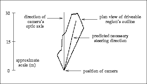
Figure 5: Plan view of the drivable region's outline, together with
predicted necessary steering direction.